Insights
Radio telemetry in a time of changing technology
Today, wildlife professionals around the world have access to more animal tracking methods than ever before. Across the board, tags are getting smaller and more powerful, making it possible to track a wider range of animals with a higher degree of accuracy.
As global pioneers of drone radio telemetry, Wildlife Drones has spent the better part of the last decade bringing radio tracking into the modern age. But how does VHF radio telemetry stand up against modern alternatives in this time of rapidly changing technology, and when is it right for your animal tracking project?
VHF vs GPS tracking – what’s the difference?
Since its introduction in the 1960s, Very High Frequency (VHF) radio telemetry has been a mainstay of the wildlife tracking toolkit. It is one of the key methods that enable scientists to locate and monitor animals in real-time and, importantly, is often the only option suitable for tracking small animals, making it an essential tool for monitoring the majority of endangered species.
However, in recent years, technological advancements have dramatically increased the versatility of GPS tags. They’re smaller than ever before, which, coupled with their extended battery life, is making high-precision GPS monitoring possible across a wider range of species.
Below we compare the key features of VHF and GPS tags.
| VHF | GPS | |
| Overview | VHF tags transmit a VHF radio signal which can be detected from the ground or air by a radio receiver. This enables researchers to locate and track the radio-tagged animal in real time. | GPS tags use the Global Positioning System to identify and record the animal’s location at regular points in time. New GPS tags usually transmit this data to a computer at regular intervals, while older versions log it for later retrieval. |
| Size | VHF tags are the smallest tags available, with the tiniest weighing in under 0.3 grams! | GPS tags have come a long way in recent years, but are still heavier than VHF tags, with most models weighing upwards of 200 grams. Newer avian GPS systems are available that weigh between 5 and 20 grams—still substantially more than the smallest VHF tags. |
| Battery life | VHF tags are extremely power-efficient, with many lightweight tags lasting for several years, although some of them are so tiny that their battery life is reflective of this. Such as ATS’s T15 which has a transmission life counted in days. | GPS tags need significantly more power to function than VHF tags, with the added battery requirement typically being what causes them to weigh more than VHF tags. However, some newer models such as ATS’s LT Solar-Cell Tracker can potentially last several years, thanks to solar charging capabilities. |
| Cost | VHF tags are the most affordable tags on the market, typically costing around $250 (approx). | GPS tracking tags are typically more expensive than VHF tags, with most models costing around $2000 (approx). |
VHF vs GPS tracking – which is better?
Both VHF and GPS tracking methods have their place in the wildlife monitoring toolkit. However, there’s a reason VHF tags continue to be one of the most commonly used tag types in wildlife conservation projects, in spite of modern advancements in satellite technology. VHF tags are more affordable, offer longer life spans, and enable researchers to locate and track their animals in real-time. These features make VHF tags ideal for:
- Tracking small, highly mobile species such as birds and bats, which often weigh less than 10 grams. With Animal Research Review Panel guidelines stipulating that transmitters should weigh less than 5 per cent of the animal’s body mass, most other transmitters simply weigh too much to be used safely on most birds and mammals.
- Projects that require researchers to make rapid decisions in the field. VHF tags transmit location data in real-time, enabling wildlife biologists to locate and follow animals on the ground. VHF tags are a particularly important tool in the fight against human-wildlife conflict, as they enable rangers to quickly identify and protect individual animals at risk of poaching.
- Assisting with the recovery of GPS tags. VHF transmitters are commonly built into GPS tags to enable these more expensive devices to be located in real-time, and to assist with their recovery in the event of system failure, battery exhaustion or tag replacement.
While VHF tags are typically more versatile, GPS tags are a valuable tool for tracking larger animals, such as wild dogs, bears and big cats. They’re also well-suited to projects where the study is focused on collecting large volumes of location data, rather than conducting in-field observations, due to their ability to passively record location data at regular intervals over an extended period of time.

Wildlife Drones has brought VHF tracking into the modern age
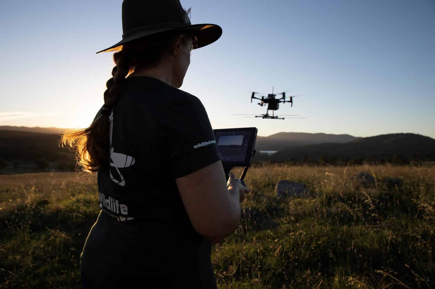
Despite being the most commonly used wildlife tracking method, VHF radio telemetry has a reputation for being slow and time-consuming, as researchers typically need to carry cumbersome radio receivers through bushland to detect radio signals. To address this challenge, and improve the quality of the data collected by VHF tags, Wildlife Drones has developed the world’s most advanced drone radio-telemetry solution.
The Wildlife Drones system is comprised of a drone payload, which includes a radio-receiver and VHF directional antenna, and a base station which receives and processes signal data from the payload. Together this technology maps all tracking data in an intuitive user interface in real time, without the need for internet connectivity.
In a single drone flight, this system enables users to:
- Radio-track up to 40 tagged animals simultaneously. Where researchers were previously limited to identifying one animal at a time, Wildlife Drones automatically detects all tagged animals within range, and relays their location to the base station.
- View animal locations in real-time. Location data is automatically relayed to the base station which maps the tracking data in real time, for easy viewing in the field.
- Save time and effort while reducing field costs. Wildlife Drones eliminates the need to hire expensive manned aircraft, or spend hours traversing rugged terrain on foot. The drone creates a natural high-point, maximising signal detection to enable large areas to be rapidly surveyed in a fraction of the time.
Already, Wildlife Drones has helped researchers around the world to collect more data, more often and with less effort than is possible using standard VHF tracking methods alone. For example the Washington State Department of Agriculture (WSDA) has adopted this technology to radio-track the invasive Giant Hornet, which is a great example of the positive wildlife management outcomes that can be achieved by combining tiny VHF tags with cutting-edge drone and data analysis technology.
Also known as Murder Hornets, Giant Hornets are the world’s largest hornet species and were first discovered in the United States in 2019, but pose a huge threat to bees and other pollinators that are crucial for agricultural crops. As part of previous eradication efforts, WSDA captured and tagged the hornets with tiny VHF tags from ATS, weighing less than 0.3 grams. The hornets were then released but proved incredibly difficult to track to their nests due to all the obstacles and barriers in the way on the ground, and the location of nests within prohibitive vegetation which was tangled and full of thorns. To address this issue, WSDA is now prepared for the coming season with Wildlife Drones’ radio-telemetry receiver, enabling WSDA entomologists to follow the fast-moving insects to quickly locate the hornets’ nests so they could be safely removed.
Wildlife Drones’ partnership with Advanced Telemetry Systems will further enhance our world-leading technology
Recently, Wildlife Drones partnered with Advanced Telemetry Systems (ATS), the tag manufacturer who has been supplying the Giant Hornet tags to work on continuously enhancing detection capabilities and pushing the boundaries of tag and tracking technology.
Doing so will help us to continue supporting researchers conducting wildlife conservation projects, like:
- Ecological Australia who we worked with to radio-track microbats across Australia. The team used Wildlife Drones’ technology to quickly survey known bat locations, including previously inaccessible locations such as gorges and sea caves.
- The Californian Dept. of Fish and Wildlife who used our technology to track Myotis bats to locate the roosts they use over fall and winter.
Curious about the best tool for you? Contact us and we’ll talk through exactly how the Wildlife Drones system can benefit your unique research.


