Insights: Drones for wildlife conservation
Drones for wildlife conservation — five ways to use drones in your conservation project
In recent years, drones have revolutionised the way scientists study wildlife. Drone cameras are more powerful, drone platforms are lighter and quieter, and new payloads have come online, making it easier than ever before to gain valuable insights into animal behaviour.
Curious about how drones could help your conservation project? In this article, we discuss five innovative ways conservation biologists are using drones to help research and restore our planet’s biodiversity.
1. To track wildlife
Animal tracking is a key component of the wildlife monitoring toolkit. By providing important insights into animals’ habitat use and behavioural patterns, tracking data enables scientists and land managers to make evidence-based decisions about wildlife conservation and invasive species management.
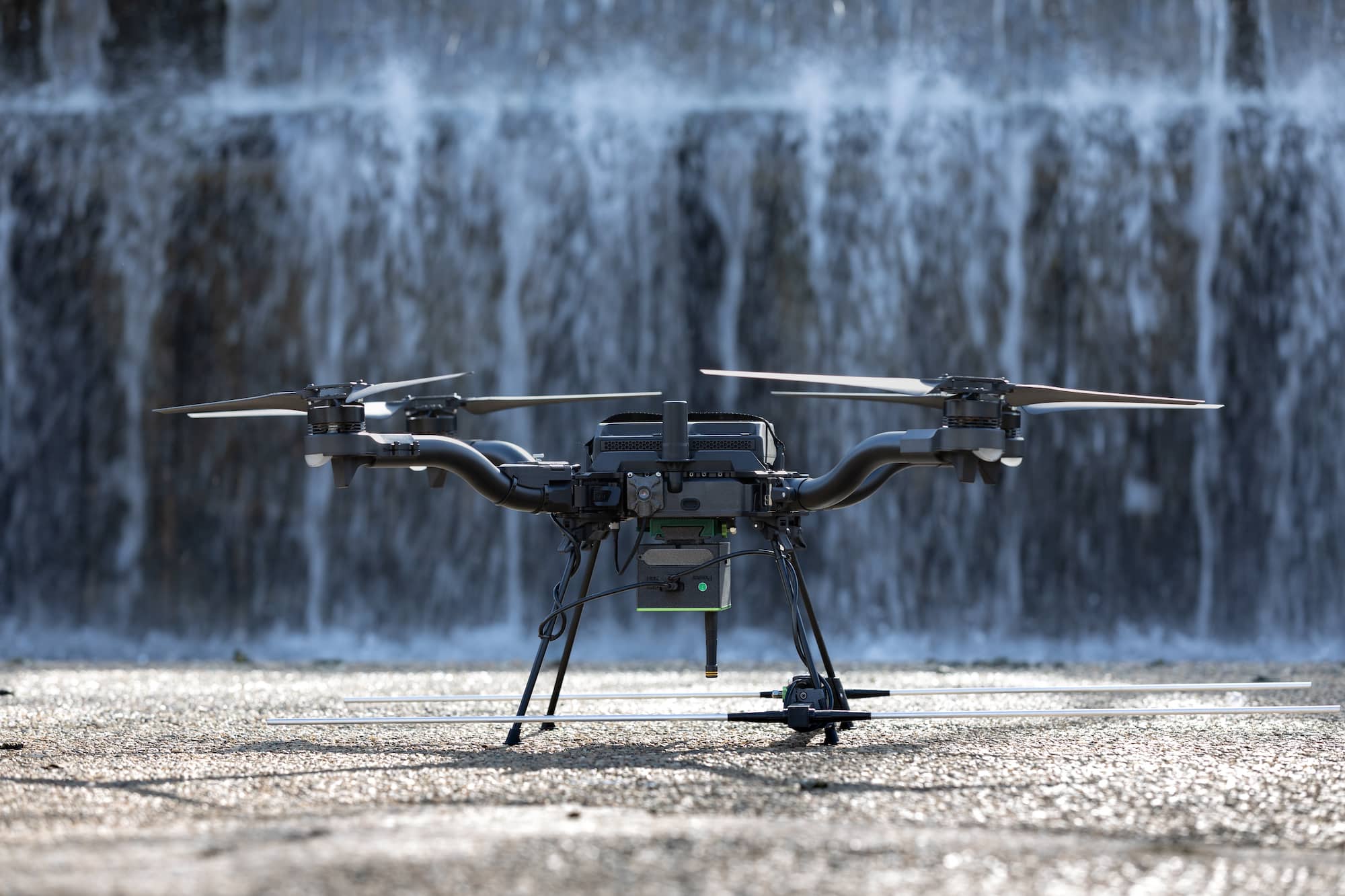
At Wildlife Drones, we’ve revolutionised wildlife tracking by developing the world’s first drone-based VHF radio-tracking system. With our technology, researchers no longer have to walk vast distances across challenging terrain to track animals one at a time. Instead, they can track up to 40 radio-tagged animals from a single drone flight, and analyse the insights in the field, in real-time.
2. To conduct wildlife surveys
Advancements in visual RGB (red green blue), video and thermal cameras, and the imaging software required to analyse the results, are making drones an increasingly useful tool for undertaking wildlife surveys. In comparison to piloted aircraft, drone flights are a safer, more cost-effective and less disruptive way to quickly survey vast swathes of land. Thermal cameras can identify cryptic species otherwise difficult to spot with the naked eye, and increasingly sophisticated processing software is making it faster to analyse the images.
3. To conduct vegetation mapping
Conservationists aren’t just using drones to survey wildlife. They’re also using drones to undertake vegetation mapping, which is an important part of the habitat restoration process. For example, the team at The Nature Conservancy in Colorado have used drones to capture before and after images of fire-affected landscapes and to map and analyse Cottonwood trees. Drones are game-changers for vegetation mapping largely because the high-resolution imagery is available at a greater spatial resolution than traditional satellite imagery.
4. To collect biological samples
Since 2015, the not-for-profit organisation Ocean Alliance has been using a specially modified drone to collect biological samples from whales. The drone flies through the whale’s blow to collect the samples that contain DNA, hormones and microbiomes, in a non-invasive way, while also transmitting drone camera and video footage back to the research team. You can find more information here.
5. To plant trees
Planting trees is typically a slow and labour-intensive process that requires an army of volunteers. Not so with a drone! Several companies have scaled up revegetation by developing seed-planting drones, including Dendra Systems and AirSeed Technologies. They’ve designed sophisticated algorithms, integrated optimal flight path planning, and can plant up to 40,000 seeds in a single day, in locations that give the trees the best chance of survival.
Contact us to find out more about how Wildlife Drones’ world-leading radio-tracking technology can help revolutionise your next conservation project and explore how these different applications can be combined for unprecedented insights and actions to help conserve our natural world.


