Insights
Overcoming the challenges of radio-tracking reptiles one drone flight at a time
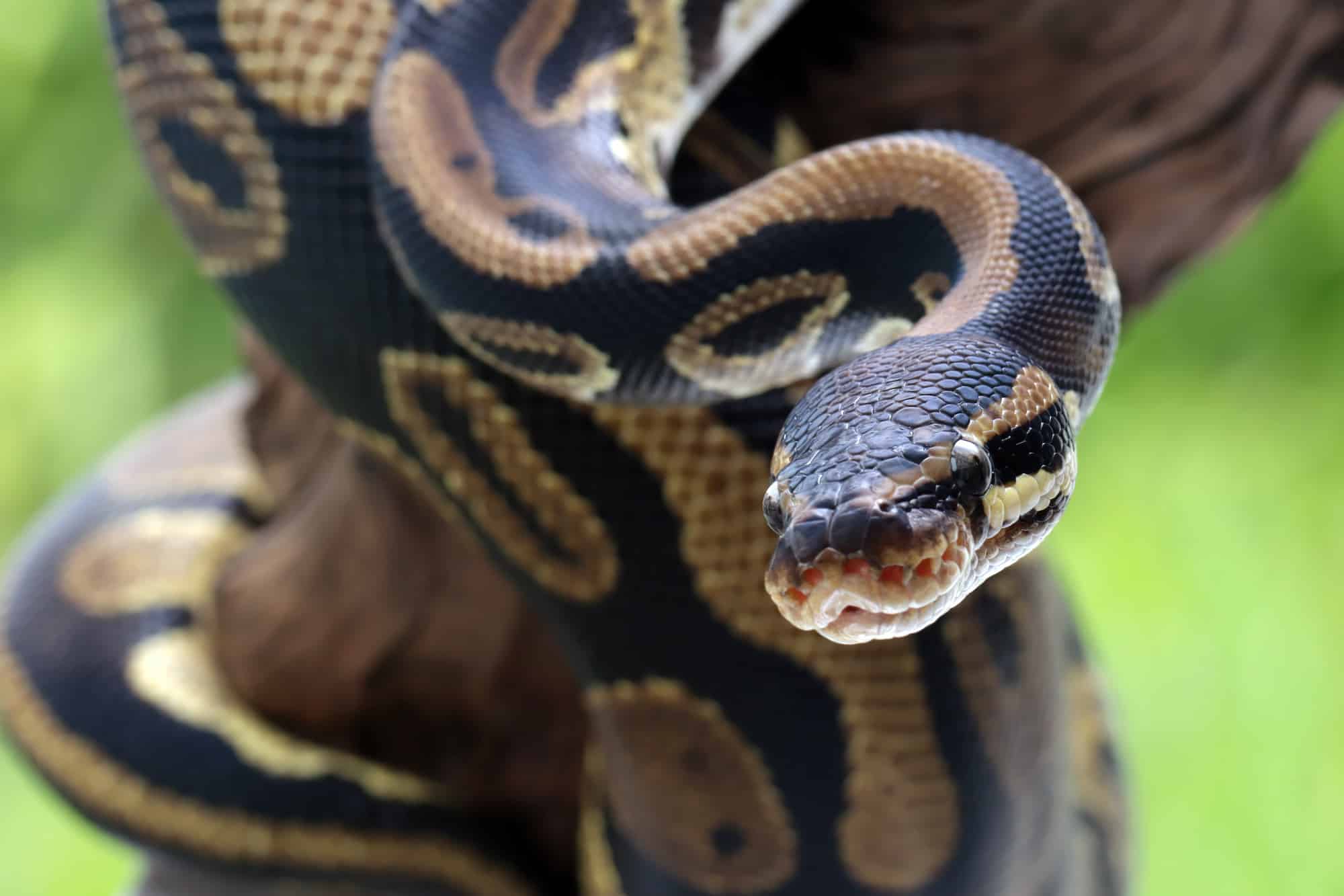
Whether it’s the invasive Burmese python, or deadly Australian brown snake, reptiles are notoriously difficult to monitor. Their cryptic nature makes them hard to spot, and they often inhabit challenging terrain, like dense tropical jungle, or swampy marshland, which makes them hard to follow with traditional VHF radio telemetry techniques. As a result, it’s estimated that as many as 25 per cent of all reptiles are data deficient.
Wildlife Drones’ innovative radio-telemetry allows researchers to detect reptiles faster and more easily than ever before
Since 2016, we’ve partnered with clients across Australia and the United States to help monitor countless endangered and invasive animals—including reptiles. Here are three case studies that showcase the capability of our cutting-edge radio-telemetry to transform the way we monitor reptiles.
1. In a world first, we radio-tracked Eastern Brown Snakes to minimise human-wildlife conflict
Found in the open grassy woodlands of eastern Australia, the highly venomous Eastern Brown Snake (Pseudonaja textilis) is one of Australia’s deadliest reptiles. Thanks to urban expansion, brown snakes are commonly found in residential areas and are responsible for the largest number of snake-bite deaths in Australia. Developing a better picture of how these snakes move between nature reserves and urban areas is essential for managing this human-wildlife conflict.
That’s where Wildlife Drones comes in. In 2022, we partnered with Associate Professor Gavin Smith, from the Australian National University and ACT Snake Removals, to help track wild and relocated Eastern Brown Snakes between the suburbs and nature reserves of Canberra, Australia.
Because radio-transmitters need to be implanted in snakes, they emit a very weak signal which is hard to follow with traditional ground-based monitoring techniques. However, our drone-based system created a clear line of sight to the snakes, meaning we could easily monitor multiple snakes in real-time, from further away than ever before. As Professor Smith said, “Being able to very quickly collect data over vast areas in real-time from the drone, which then leads us directly to where the snakes are, is really fantastic.”
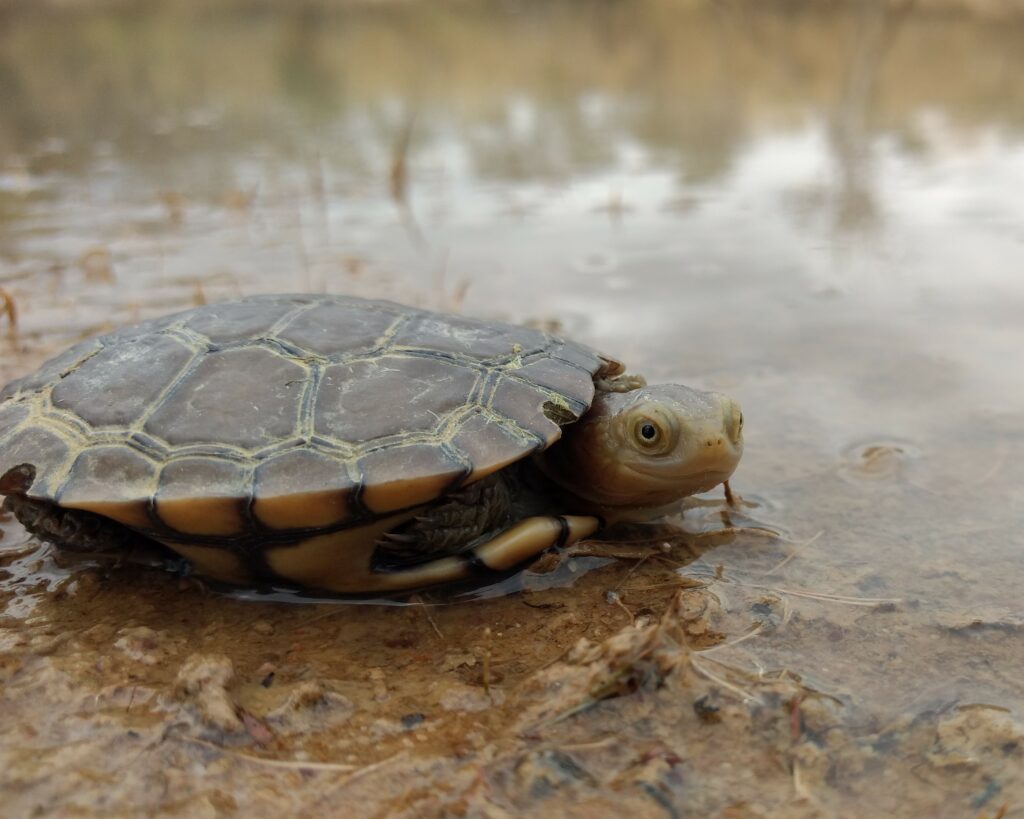
2. We’ve successfully tracked Australia’s most endangered reptile
Once thought to be extinct, the Western Swamp Tortoise (Pseudemydura umbrina) is Australia’s most critically endangered reptile. And thanks to its wetland habitat, it’s also one of the hardest to monitor. During the winter and spring, these tortoises spend most of their time in the middle of swamps, feeding on small invertebrates, frogs and tadpoles, making them impossible to reach on foot. Add to that the short detection distance of their tiny VHF tags and it’s near impossible to get accurate data on their movements.
By flying our drones over the wetland, and plotting the tortoises’ locations in real-time, we enabled the team at the University of Western Australia to easily obtain the movement data essential to informing Western Swamp Tortoise conservation efforts—all without needing to get their feet wet!
But our turtle tracking efforts don’t stop there. In an exciting proof of concept trial, we’ve worked with Chevron and Pendoley Environmental Consultancy to develop a method to radio-track sea turtle hatchlings swimming offshore. You can find out more here.
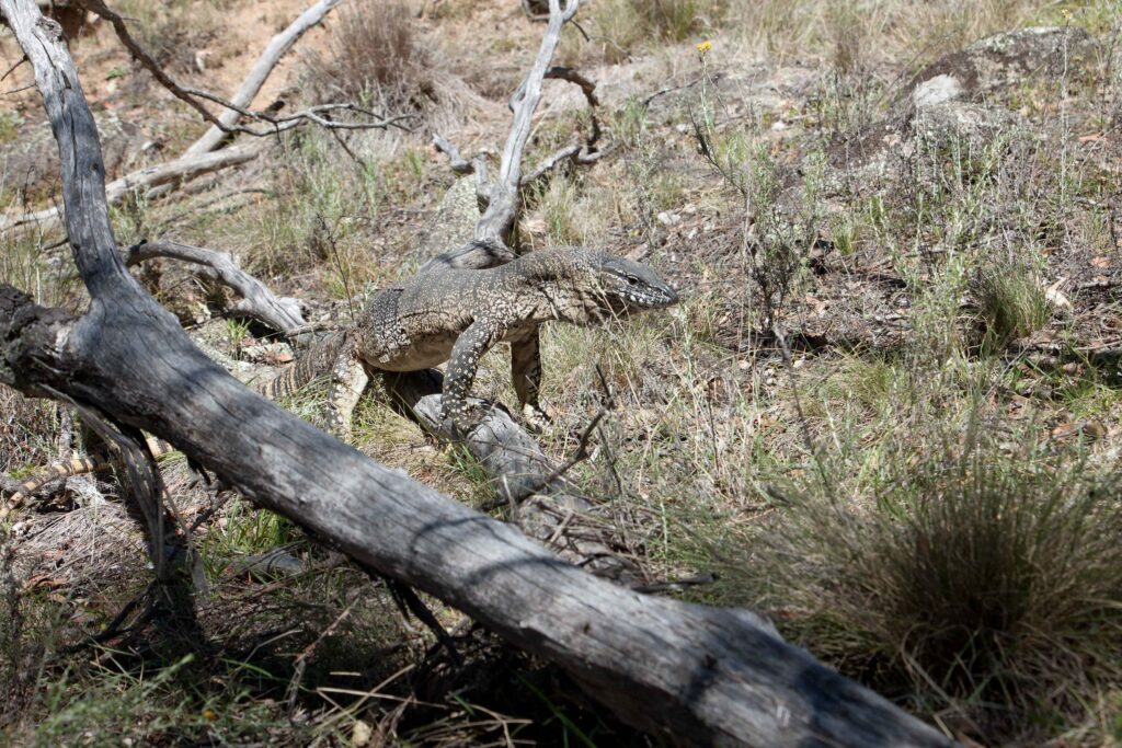
3. We’ve proven it’s possible to overcome signal bounce and make tracking Rosenberg’s Goanna’s a breeze
One of the things that makes tracking reptiles so difficult is that they often live in rugged terrain, where the radio signals emitted by their tags are prone to bouncing. Without a clear signal, it’s incredibly difficult to pinpoint their exact location.
The National Parks Association (NPA) of the ACT asked Wildlife Drones to help overcome the problem of signal bounce, so they could build a better picture of the Rosenberg’s Goanna population in Namadgi National Park. Thanks to the natural high point created by our drones, we were able to quickly locate the tagged goannas, and remotely download GPS data from their tags without physically disturbing them.
In the words of NPA ecologist, Dr Don Fletcher, ‘If we can just fly a drone overhead and collect GPS data without having to negotiate cliffy areas and Blackthorn scrub, it saves lots of time and energy and a few twisted ankles.’
Get in touch today to learn more about how our world-leading system can help you with your next reptile tracking project.