Insights
Challenges of tracking highly mobile species with traditional technologies
Small, agile and capable of travelling vast distances, mobile species like birds and bats are notoriously difficult to monitor. As well as moving quickly through the landscape, their small size often means they can only be tracked with tiny Very High Frequency (VHF) radio tags.
In this article, we discuss the challenges of tracking highly mobile species, and how finding a solution to tracking the Swift Parrot inspired Dr Debbie Saunders to start Wildlife Drones.
What makes highly mobile species so difficult to track?
Whether it’s the tiny Indiana bat, or the critically endangered Regent Honeyeater, highly mobile species share a number of common characteristics that make them more challenging to track than most other species. They typically:
- Cover vast distances, which makes them difficult to locate and monitor, even once tagged. For example, more than 350 birds in the United States migrate vast distances along flyways between Canada, the United States and Mexico, making it nearly impossible to estimate where the birds might be at any one time!
- Move quickly, making it difficult to detect their signal as they often aren’t in one location for very long. Once the signal is detected, it is then hard to keep it within range to follow the animal.
- Visit different locations within their home range. For instance, the precise location Swift Parrots visit each year within their winter range on mainland Australia varies according to seasonal food availability. This means researchers often have to rely on being in the right place at the right time to locate the birds.
These challenges are compounded by the fact that many highly mobile species are so small, they can only be fitted with Very High Frequency (VHF) radio tags. While modern GPS tags are a lot smaller than their bulky predecessors, approximately 70 per cent of bird species and 65 per cent of mammal species are still too small to be tracked using GPS devices.
Wildlife tracking with VHF radio tags is typically time-consuming and resource-intensive
By providing important insights into animals’ habitat use and behavioural patterns, tracking data enables scientists and land managers to make evidence-based decisions about wildlife conservation and invasive species management.
Wildlife tracking with VHF radio tags is a key component of the wildlife conservation toolkit. It’s the only tracking method suitable for many birds and mammals and is one of the few technologies that enable animals to be located and monitored in real time.
However, tracking animals fitted with VHF radio tags on foot with hand-held receivers has a number of limitations. This tracking method is:
- Slow and resource-intensive as researchers are restricted to tracking animals one at a time. Tracking animals on foot is time-consuming, as it typically requires researchers to carry cumbersome equipment across challenging terrain.
- An imperfect means of collecting data. Hand-held receivers often have a signal detection range of only a few hundred metres, making it hard to detect and follow fast-moving animals. Researchers are also often unable to access areas needed to track animals, such as dense bushland, swamps, gorges or cliff-tops.
Wildlife tracking towers overcome some, but not all, of these challenges
To overcome the challenges of tracking small, fast-moving animals across vast distances, a team of researchers developed the Motus Wildlife Tracking System—a network of receiver stations placed throughout the landscape (predominantly in the Northern Hemisphere) that automatically detect and record signals from passing radio-tagged animals.
Motus enables researchers to simultaneously detect many tagged birds, bats or insects that pass the tracking stations. By plotting the tracking data received by each station, researchers can develop a broad map of animals’ movements. This is particularly beneficial for tracking long-range migrant species that are difficult to follow over vast landscapes.
However, MOTUS still delivers an incomplete data picture. It only records the signals of animals as they pass the station, so doesn’t provide the location-specific data scientists need to find their animals on the ground in real time. Being constrained to capturing data within the tower’s range also means that as soon as animals move outside the tower network they can no longer be detected, meaning valuable data points are lost as soon as animals move beyond the tower.
The challenges of tracking Swift Parrots inspired Dr Debbie Saunders to start Wildlife Drones
For over 20 years, Dr Debbie Saunders has worked as an ecologist studying the movements of small migratory birds, including the Swift Parrot. However, being a highly mobile creature has traditionally made tracking Swift Parrots a near-impossible feat!
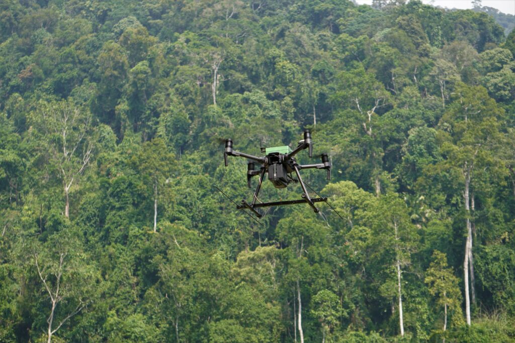
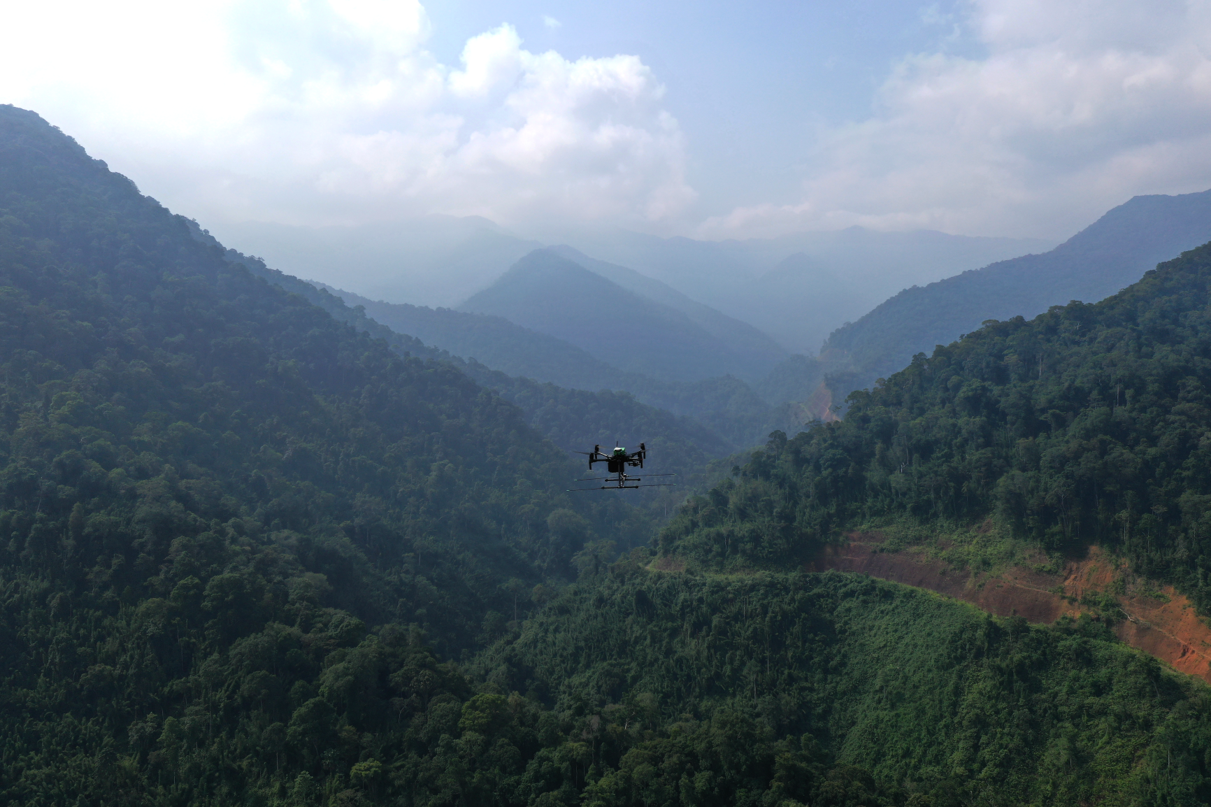
To overcome the challenges of VHF radio tracking, and enable scientists to build a clear picture of birds’ migratory patterns, Debbie led a research team to develop the world’s first drone-based radio-tracking system. Since then, Wildlife Drones has revolutionised the wildlife monitoring industry and is paving the way for more sustainable and regenerative conservation management.
Our system enables animals to be tracked wherever they go, making tracking animals faster and simpler, and improving data quality by:
- Maximising signal detection. Mounting the system to a drone creates a natural high point which reduces interference from landscape features that would otherwise block, attenuate or bounce the radio signal.
- Unlocking otherwise inaccessible terrain. The drone’s manoeuvrability grants access to rugged landscapes that are otherwise difficult to reach, such as this sea cave, where we helped Ecological Australia track microbats. With our system, users can quickly survey vast areas, so if you have species moving quickly around a particular area, you have a better chance of picking up their signals.
- Detecting up to 40 unique VHF signals at a time, enabling users to track multiple animals simultaneously. This is a game changer for highly mobile species that would otherwise move quickly outside of the search field.
- Enabling real-time data processing and display. Signals are processed on the receiver within ten seconds of detection, enabling them to be plotted in near-real time. This allows users to make rapid decisions in-field, by removing the need to post-process data.
Get in touch with the team at Wildlife Drones today to start using our world-leading technology to simplify your next wildlife tracking project.